


3D digital surveying and modelling of cave geometry: Application to paleolithic rock art. González-Aguilera, D., Muñoz-Nieto, A., Gómez-Lahoz, J., Herrero-Pascual, J., Gutierrez-Alonso, G., 2009, Sensors, 9, 1108-1127. DESCARGAR-DOWNLOAD.
RESUMEN-ABSTRACT
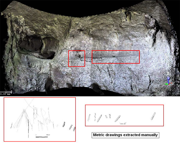
3D digital surveying and modelling of cave geometry represents a relevant approach for research, management and preservation of our cultural and geological legacy. In this paper, a multi-sensor approach based on a terrestrial laser scanner, a high-resolution digital camera and a total station is presented. Two emblematic caves of Paleolithic human occupation and situated in northern Spain, “Las Caldas” and “Peña de Candamo”, have been chosen to put in practise this approach. As a result, an integral and multi-scalable 3D model is generated which may allow other scientists, pre-historians, geologists…, to work on two different levels, integrating different Paleolithic Art datasets: (1) a basic level based on the accurate and metric support provided by the laser scanner; and (2) a advanced level using the range and image-based modelling.